Thursday, October 25, 2012

Weedon Island


Everyone raised in St. Petersburg has heard of this 3,700-acre expanse of green along the western shore of Tampa Bay, and has seen at least that part of its shoreline which is visible from Gandy Bridge. But most people are not aware you can hike on it, and who can blame them? Since Weedon Island’s recreational reputation is built mostly on sea kayking and shallow-water fishing -- and mangroves make up all of its plant life you can see from afar -- it would be logical to wonder if it even has any dry land.

For any non-Floridian readers out there, mangroves are estuary trees which grow in areas that are, more often than not, submerged in salt water anywhere from several inches to several feet deep. They sit atop above-ground roots, as you can tell from this picture that was taken when the water level was lower than normal:


The shallow aquatic world around mangrove roots is home to crabs and crayfish and provides a steady food supply for droves of raccoons. Herons also come here to feed:


There is much more to Weedon Island than mangroves, however, for its interior is home to upland fields and woods:


That interior is teeming with a variety of wildlife, including endangered species like the gopher tortoise. 4½ miles of hiking trails thread through Weedon Island, leading to two inland ponds, three viewing platforms, and a 45-foot tall observation tower. They are dirt in some areas, paved in others, and where necessary (i.e., mostly around the perimeter) they use boardwalks to ensure you stay dry while slipping through the mangroves:


Although it is called an island, Weedon is actually a peninsula, tethered to Pinellas County’s mainland by a small isthmus of land south of Gandy Boulevard. A two-lane road across that isthmus is what takes you there. When I was a child, the road was dirt and dead-ended near a dock. The bulk of Weedon was known as Weedon Island State Preserve, but unless you had a kayak in tow, there was really nothing to do here.

These days the land is leased to Pinellas County and known simply as Weedon Island Preserve -- and man oh man, has the county ever upgraded things! In addition to blazing the trails and paving the road, it has built a cultural and natural history center to honor Weedon’s rich human history. Archaeological excavations on the island have unearthed a plethora of tools and pottery, plus a canoe that has been carbon-dated to be more than 1,000 years old. Many of these artifacts are now on display in the center.

To reach the preserve, turn south onto San Martin Boulevard from Gandy Boulevard, or east onto 83rd Avenue from 4th Street, and follow the signs. Admission is free. Whether you live in the Tampa Bay area or are simply visiting, you will be doing yourself a disservice if you fail to visit this wild spot in the midst of a metropolis.


Happy Trails!

Sunday, October 7, 2012

Moccasin Lake

In the middle of Clearwater, right next to the commercial corridor of U.S. 19, sits a woodland whose oak canopy stretches over magnolias and shares space with a handful of oddly located slash pines.


These woods are city property and are preserved as Moccasin Lake Park. They are home to a classroom where the Audubon Society meets every month, and as you might expect, their bird-watching is very good. When I visited for the first time on a Saturday last month, I saw a pair of red-shouldered hawks fly through the trees within seconds of stepping onto the trail. Not long after that, I was treated to the sight of a pileated woodpecker.

However, the most notable sighting was of the non-native variety, when I stumbled upon a flock of peacocks. In Florida it is not unusual to see an occasional, escaped specimen of these showy birds roaming about, but when I rounded a bend in the park’s trail and found myself looking at about twenty of them, including chicks, I realized I was in the presence of a wild, established, and reproducing population.


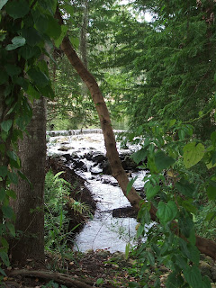
The trail through Moccasin Lake Park is a mile long (one-way) and easy to follow. It forks several times, and the resulting prongs always rejoin even though the signs usually point you in only one direction. It has a few boardwalk sections, one of which passes over a swiftly flowing stream.


At one point the trail comes close to a couple of homes, then plunges back into the woods and eventually reaches Moccasin Lake itself: a five-acre body of water where you might see multiple species of wading birds. One of U.S. 19’s overpasses is just beyond the lake’s western bank, but in a way that enhances rather than detracts from the natural appearance by making you appreciate that such a setting exists in an urban area. The two best spots for viewing the lake are from a covered dock on its eastern shore and a bird blind on its northern one. I took this photo from the latter:


There is quite a bit more to this place than what I have already mentioned. Behind the visitor center are enclosures, mostly aviaries, that injured animals call home; among their current residents are a screech owl and fish crow. A path branching off of the primary hiking trail leads to a wooden windmill and butterfly garden where the winged critters flitter about and flower species are identified by signs:


Obviously, Moccasin Lake Park is not for you if you are looking to walk long miles through wilderness, but it is a fine place to easily escape the congestion of the city. When daytime highs are hot, as they often are around here even in fall and spring, a two-mile round-tripper in the shade of oaks might be all you need.

To get to Moccasin Lake Park, turn east onto Drew Street from U.S. 19, then left onto Fairwood Avenue. Six-tenths of a mile later, just past the train tracks, take another left onto Park Trail Lane, which dead-ends at the park. There is a $3 entry fee, and if you intend to bring the family along, be aware that the fee is per person. Happy Trails!