Showing posts with label pasco county hiking trails. Show all posts

Monday, December 31, 2012

Again to CCN

Christmas was bookended by a pair of cold snaps that dusted parts of the Bay Area with frost:


The low temps seemed to invigorate wild animals rather than discourage them, as evidenced by the cries of hawks that frequently pierced the air and the large numbers of sandhill cranes seen milling about:


With that kind of atmosphere greasing the skids into 2012’s final weekend, there was no way I could let the weekend pass without exploring some woods, even if our calendar showed things scheduled. So yesterday morning I made my way to the Cypress Creek North Trail Network for the first time in nine months.

In March I wrote two posts about this network that can be read here and here. The second post mentions a 1½-mile section of side trail that “is crossed by several other trails that lead to…well, right now I don’t know, but hey, that gives me a reason to come back!” Those other trails were my destination yesterday.

Because we are entering rather than exiting winter, the foliage is more scant right now than it was the last time I was here, a fact to which these bald cypress can testify:


To reach the trails I had in my mind, it was first necessary to head east for 1.3 miles on the paved path that serves as Cypress Creek North’s main artery. Almost immediately after using a culvert to pass over the creek itself, the paved path is crossed by an earthen trail onto which I turned right and trod into a forest of mixed hardwoods.

Just under a half-mile later, as that trail begins to emerge into a more open landscape, it encounters a pair of side trails marked by signposts 4 and 8. The first is on the right and plunges 
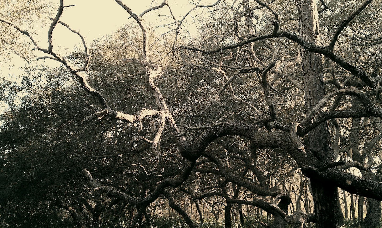
into moist-looking woods dominated by oaks. The trail itself consists of deep, lumpy dirt that has the appearance of never being dry anywhere there is shade:


Several steps beyond that, the second side trail turns left and heads into a pine flatwood that is slightly higher and considerably drier:


A quick glance at the two photos above shows just how abruptly one Florida ecosystem gives way to another. As far as beauty and adventure are concerned, the first trail looks more promising; however, I opted to walk the second one because I was wearing tennis shoes instead of my hiking boots and didn’t want to find myself sinking ankle-deep in mud.

The flatwood through which the second trail passes is thick with hip-high palmettos, but it has no canopy because the pines are so spread out. You will find two decision points soon after stepping onto this trail: first at an unsigned side trail branching off to the left, then at an intersection with another unsigned side trail, which goes off in both directions. I kept moving straight, wanting to see how long this particular trail is and hoping it would go far. I learned it does not, however, for it ends at a T intersection after little more than a third of a mile.

While you can choose to go either right or left at the T intersection, it was hard not to notice the barbed wire fence on the other side of the intersecting trail, which told me that any further travel in that direction was probably verboten. Although the intersecting trail is composed of the same sort of deep, lumpy dirt I skipped back at signpost 4, I chose not to skip it this time. Because these woods are sunnier than the ones at signpost 4, I figured the dirt here at least wouldn’t be wet from the prior morning’s rain -- plus there is a wooden observation tower to the left and I wanted to find out if it is accessible.

It turned out the dirt was dry like I hoped, and soft and deep like I expected. Covered with abnormally deep deer tracks, it gave under my weight with a sensation reminiscent of Rocky Mountain snow. Unfortunately, when I got to the tower I found that access to it is denied by the barbed wire, but at least it makes for a nice photo in its own right:


As for the earlier decision points I mentioned, I did go back and check them out, discovering that one-fifth of a mile is a recurring theme. At the first decision point, the unsigned trail on the left travels one-fifth of a mile before petering out at a spot where the flatwood gives way to a mixed forest that is thicker with trees. It was there that I saw these young maples holding on stubbornly to their autumnal leaves:


At the second decision point, you will walk approximately one-fifth of a mile regardless of whether you turn left or right. A left turn takes you to a T intersection with the same deep dirt trail that passes the observation tower, while a right turn empties you back onto the same side trail that brought you here from the main artery. Interestingly enough, the spot where you empty back onto that side trail is one-fifth of a mile past the spot where you left it!

I can not lie: I wish this network of side trails off a side trail would delve farther into the preserve than it does. Even if the barbed wire marks a property line, I could not detect any reason why the trail from “decision point one” has to stop at the maples instead of probing past them into the forest beyond. But it is still worth your time to come to these paths, especially when you consider that they are a decent ways into the preserve, and are but one piece of an extensive network of connected trails that you can explore while here.

For directions to the trailhead, please visit the first of the links I included earlier in this post. Happy Trails!


Tuesday, March 20, 2012

Back to Cypress Creek North

It was 58 degrees and clouds were few when I entered Cypress Creek Preserve on Sunday morning, eager to explore parts of its northern trail network that I skipped on my previous visit:


Birdsong filled the air from the very beginning. At one point, I could make out so many individual tunes within the cacophony that there had to be representatives from more than a half-dozen species singing at the same time.

If you read last week’s post, you may recall that on my previous visit I skipped the first side trail and took the second one -- and later consulted the trail map, at which time I noticed it portrays these not as separate trails but as a single one which “travels north from the paved path at milepost 0.7 and eventually curves back to the south, crossing the paved path again at milepost 1.3.”

Well, after Sunday morning’s visit I can confirm that the trail map is correct on this point. From 0.7, the trail’s horseshoe route totals about 1½ miles before its crossing at 1.3. For most of this route it travels through hardwood forests, parts of which are downright jungly. I will not claim that the girth of the following trunk equals the biggest ones I saw in the Northwest, but when I say it brings those trunks to mind, I absolutely mean it:


One word of warning: Be aware that you may have to slog through standing water if you hike this trail during the wet season, because a third of a mile from 0.7 it crosses the creekbed of Cypress Creek’s headwaters without benefit of a bridge. On Sunday the creekbed was dry, but it is sure to be flowing once the rains come; and as you know, you stand a strong chance of running into alligators and cottonmouths anywhere in this state you see water.

But anyway, continuing southward after the 1.3 crossing, the trail drops several feet downhill and enters a much drier habitat where fields of bluestem are backed by treelines of maple and pine:


This section of trail continues for its own 1½ miles before dead-ending at a fence, and along the way it is crossed by several other trails that lead to…well, right now I don’t know, but hey, that gives me a reason to come back!

In the meantime, I can tell you that another thing I learned on Sunday’s visit is that if you take the right fork where the paved trail splits (I took the left one last time) you will only go about a third of a mile before reaching its end and having to turn around.

And, I can let you know that this trail network is a primo place for viewing wildlife. After seeing lots of creatures the weekend before, Sunday’s visit turned up two pileated woodpeckers, a pair of storks, and five whitetail deer -- four of whom darted across the path no more than 30 feet in front of me.

I will leave you with a photo of a tree that my last post described as “the tallest live oak I have ever seen.” While last week’s dim light resulted in a photo that was little more than a silhouette, Sunday’s brightness did a better job revealing contrast and showing Spanish moss hanging from the branches:


Happy Trails!

Monday, March 12, 2012

Cypress Creek North


Back in January I wrote about a trail network in the west central portion of Cypress Creek Preserve. Temperatures in the low sixties drew me back to Cypress Creek on Saturday, but this time I decided to check out the trail network in its northern section -- which, amazingly, I had yet to hike despite living only 20 minutes away.

The network’s main artery is a paved trail that cuts across the property from west to east and is wide enough to be considered a road. It connects with a number of dirt trails that, needless to say, have a more “wildernessy” appearance:


However, the paved one was more productive for wildlife viewing when I was there, turning up nine deer and a big alligator. Although its size does not fully translate in this picture, judging by the distance between the gator’s forehead and nose as compared to the plant life, I would estimate him to be about eight feet long:


I travelled more than three miles on the paved trail, passing four dirt trails that were signed and a few more that were not signed, before opting to turn around and try some of those side paths. Right before doing my about face I heard the loud rattling call of a sandhill crane and glanced up to see it flying in my direction. It landed nearby and I thought of how fascinating it is that this species, which I see almost every day in Florida, lives as far away as Siberia:


From the preserve’s entrance it is 0.7 miles to the first signed side trail, which travels north from the paved path; and 1.3 miles to the second, which crosses the paved path just after a culvert through which Cypress Creek flows underfoot. Because those trails enter woods that appeared more lush than the woods entered by the more easterly trails, I skipped the easterly ones and backtracked all the way to the trail at the 1.3-mile mark.

Going north, the first ¾ mile on this trail travels alternately through hardwood forests and pine-ringed palmetto fields before the former finally prevails in a kind of battle of the ecosystems. At first the canopy is open but soon it closes up:


At one point I gazed up at the tallest live oak I have ever seen, and it made me understand why Hollywood executives chose Florida as the place to film those old Tarzan movies starring Johnny Weissmuller:


A little more than a mile after turning onto this trail, I had my most heart-stopping wildlife encounter in over two years. I was minding my own business when a large mammal stepped onto the trail no more than 20 feet in front me, travelling right to left and totally oblivious to my presence. Its jet black fur made me wonder if I was looking at a bear, but then I noticed its snout and realized I was sharing space with a wild hog.

Aware of their not-so-friendly reputation, I stopped in my tracks and apparently was not quiet in doing so. The hog glanced in my direction and saw me, then he jumped sideways and hustled off into the underbrush, providing a glimpse of his side profile that looked impeccably like the Arkansas Razorback of football helmet fame. Not knowing whether hogs travel solo or in groups, I interpreted his presence as a message to get the hell out of there.

I felt a few raindrops, and, knowing I was already on pace to log more than eight miles by the time I got back to the car, decided to wait until next weekend to try the first side trail. I can not wait to see what awaits me then, given how much new, here-comes-spring foliage I saw on Saturday:


There are a few things about the “Cypress Creek North” trail network you should know. For one, I am not convinced of how reliable the trail map is. Assuming you hike west to east like I did, the map shows the paved trail forking near the preserve’s eastern boundary, with the left fork turning north and continuing to go north; however, I took the left fork and found that it soon shifted to an east-southeasterly direction. Where I turned around, it was heading in that direction in a straight line and I could not see the end, so until I explore more and write about what I find, take that for what you will.

Also, after consulting the trail map when I returned home, I noticed it shows that the first and second side trails are one and the same. According to the map, it travels north from the paved path at milepost 0.7 and eventually curves back to the south, crossing the paved path again at milepost 1.3. As soon as I confirm whether that is true or false, I will let you know.

And lastly, you should know that accessing this network is not as easy as accessing the one I wrote about before. From Ehren Cutoff, turn onto Pump Station Road and drive to its end, where you will be stopped by a security gate beyond which buildings can be seen. There are warning signs about needing to register before entering, but they are intended for visitors to the well houses, not visitors to the preserve, so feel free to park on the shoulder and use the walk-through opening in the fence. Then, continue walking 0.3 miles to the actual preserve entrance, which is visible the whole way:


If you don’t like the idea of hiking on pavement, a good idea would be to bring your bike and pedal to the various trailheads. That would save a lot of time getting from one trail to the next, and give you more time to explore each one. Happy Trails!


Monday, January 30, 2012

Serenova


The 6,533-acre Serenova Tract is located in western Pasco County, with a single roadside entrance granting access to its 18 miles of trails. It borders Starkey Park to the south, which in turn borders the Anclote River Ranch Tract to its south, and together they form what is known as Starkey Wilderness Preserve.

Serenova’s entrance is on the south side of State Road 52 across from the end of Hayes Road, two traffic lights west of the Suncoast Parkway. From the parking area, hikers and mountain bikers enter through a walk-through opening in the fence while horseback riders enter through a cattle gate. The separate openings result in separate paths at the beginning, but they merge very soon and every mile of trail is open to hikers, bikers, and equestrians alike.


About 1½ miles south of the entrance, the merged trail forks and proceeds to branch out into a series of far-reaching, interconnected loops. A power line travels the length of the preserve on a tight northeast-to-southwest angle, and the break beneath, which is crossed by several of the loops, can be used as an alternate hiking route. The trail map shows the power line and is quite reliable as long as you remain on paths that are signed.

Something I like is that Serenova contains numerous bodies of water despite not seeming all that watery. The Pithlachascotee River bisects it from east to west and several lakes are visible from the trails. Given the length of the trail network, you can walk past the same lake at different times of day and see what it looks like in different light:


Some 150 species of birds have been documented here, coming in all shapes and sizes. On a recent hike I watched a wood stork fly overhead and land in a tree, chasing away a white ibis that had been perched there. A minute later, when I held up my cell phone to snap a picture, the stork took flight and I was lucky to capture him in a full nose dive. It is hard to believe digital photography has come so far that I was able to capture this shot from a phone:


Other creatures in Serenova include scrub jays, gopher tortoises, and rattlesnakes. It may excite you to know that black bears have been documented here, though it is not known whether they are residents or simply pass through on occasion.

And if you are a history buff, it may excite you to know that a decaying chimney deep in the woods has long been rumored to be the remains of a hideout used by Al Capone.

Less than a half-mile into the preserve is a camping area that offers a good option for experiencing it. You can pitch your tent after work on a Friday, then arise before dawn and have time to explore the entire trail network by nightfall, then bed down again on Saturday and be home well before lunch on Sunday.

The camping area is comprised of an equestrian site on the east side of the trail and a non-equestrian site on the west, with a latrine in between. Each site is shaded by live oaks and is so spacious that it looks like it could accommodate a dozen tents with plenty of room to spare. Picnic tables and fire rings (which double as grills) are spread throughout. Serenova is owned by the Southwest Florida Water Management District, and as is the case with practically every campsite on district property, these are immaculate despite not having electricity or running water.

You will be cheating yourself if you fail to check this place out. Happy Trails!


Wednesday, January 11, 2012

Cypress Creek Redux


Last week I wrote about Cypress Creek Preserve, and today I feel the need to supplement that post, especially when it comes to the unsigned trail I described as traveling “for a considerbale distance along the spine of what passes for a ridge in Florida.”

After publishing the post, I realized that despite visiting Cypress Creek quite often, it had been a few years since I really bothered to walk that particular trail. And when I mentioned that last winter “Sarah and I ventured down off the ridge and were met by an armadillo,” I didn’t think to mention that we did our venturing less than 100 steps past the point where the trail “enters the shadows of a hardwood canopy, turns south, and narrows”...so of course, I also didn’t think to mention that that was as far as we went that day.

Therefore, I returned to Cypress Creek this weekend to sharpen my memory of the trail, and here I am this evening, seeking to offer some more details about it as well as to clarify some points about the preserve in general.

For one thing, this weekend’s walk reminded me that the trail does not travel a singular ridge, but a dual one. Not very long after turning south, it forks into parallel paths atop parallel ridges with the one on the west notably higher than the one on the east. This picture was taken from the west ridge looking over at the eastern one:


Sarah wanted to cross from one to the other and I told her to go ahead. Here she is in the saddle between them:


Because I previously wrote that the trail travels “a considerable distance,” this weekend I brought my Garmin wristwatch so I could measure it and be more specific. My friend Tom and his son Jackson were with us, and we did not follow the trail to its end due to being somewhat slowed by the kids; however, we had walked a half-mile past the trail’s “turns south” point when we decided to turn around. This was at a spot that is obvious because: 1) the path up ahead starts looking overgrown, and 2) off to the right, a house suddenly comes into view.

If you check out the trail map, you will see a spot where the preserve narrows so much that it is pinched inward by private property. I believe that is the precise spot where we saw the house and turned around. (Remember that this trail does not appear on the map, and, unlike the others I wrote about last week, is not signed.)

Anyway, in my previous post I said that you will not see Cypress Creek itself on the trail network I was writing about. However, now I think I was wrong. This weekend I snapped the following picture at the bottom of the east ridge, and looking at it along with the map I linked to above, I am pretty damn sure this has to be Cypress Creek:


And here is something else worth mentioning -- if you hike this trail soon, you will find that it reveals that much of Florida’s fall foliage lasts all through the winter:


If you hike it with your kids, you may learn a thing or two about perspective. Most adults (including me) would consider an old stubborn vine draped across a trail to be an obstacle, but Sarah and Jackson immediately saw it as a swing to be played on. Jackson seemed to enjoy it even though his extra heft caused him to bottom out:


One last thing I want to point out is this: When I said last week that the trail network totals 12 miles, I was quoting the preserve’s own web site; but when I attributed mileage to specific trails, I was “quoting” my Garmin.

Happy Trails!

Monday, January 2, 2012

Cypress Creek

Cypress Creek itself is one of the Hillsborough River’s major tributaries. Cypress Creek Preserve was established to protect its water quality by setting aside the wetlands that feed it, as well as the higher, drier woods around them:


The preserve encompasses 7,400 acres around the creek’s upper reaches in Pasco County, and ranks as one of my sentimental favorites because it is the first place I went hiking when I decided to start appreciating our area’s wild lands back in 2005. It is within 15 minutes of my home, so I visit quite often and have spent more time there than in any of the other places mentioned on this blog.

The preserve is elongated from north to south, with one trail network branching across its northern portion while another delves through the west-central portion. Today’s post covers the latter, which totals more than 12 miles and is accessed from an entry point on Parkway Boulevard. The trails are unpaved, but the phrase “Jeep roads” would be an accurate description for most of them:


To the delight of hikers, a cattle gate at the entry point keeps cars out. After entering through the fence’s walk-through opening, you will see the primary trail heading due east straight as an arrow. It eventually proves to be a 2.4-mile lollipop loop, and every other trail in the network branches off from it.

Much of the primary trail travels through fields instead of forests, though the forests are so close it feels like you could touch them. If you pay attention you will notice that the fields are home to a surprising variety of plant life in all shapes and sizes:


In the first half-mile you will encounter four junctions with other paths. Two are on the left-hand side, marked by signposts 2 and 5, and will be described later. The others are on the right-hand side, marked by posts 4 and 7, and are actually opposite ends of the same, relatively short side path.

Roughly six-tenths of a mile into the preserve, post 8 is the spot where the primary trail splits to begin its loop. The left fork has the same packed-earth surface on which you have been walking since the beginning, while the right one switches abruptly to a grassy surface. Along the loop you will encounter a three-way intersection, marked by post 10, that can be confusing if you don’t know where you are going -- so be sure to turn right at that intersection if you go clockwise or left if you go counter-clockwise.

The loop provides great birdwatching, as it is where I have seen coveys of quail and flocks of turkeys and some very big red-shouldered hawks. It is also where you will find both campsites: One labeled “primitive” on the inside of the loop, and the other as “equestrian/group” near the end of a signed side trail on the outside. Both are very spacious; both have multiple fire rings; both have sheltered picnic tables; and both have clean port-a-lets that are very well set-aside. These sites are among the best you will find despite not having any electricity or running water. This picture shows part of the one labeled “equestrian/group”:


About halfway through the loop is another obvious side trail on the outside. Although it is unsigned and does not appear on the trail map, there is no way anyone who is adventurous can pass by without exploring it. It goes east a short ways to a tree line, at which point it enters the shadows of a hardwood canopy, turns south, and narrows. Then it travels for a considerable distance along the spine of what passes for a ridge in Florida.

Of all the trailways mentioned in this post, the segment on the ridge -- elevated above terrain that is often wet -- is the only one narrow enough to avoid being called a Jeep road. During a dry spell last winter, Sarah and I ventured down off the ridge and were met by an armadillo:


But about those side trails I mentioned earlier, after entering Cypress Creek you come to the first one almost immediately at post 2. The one at post 5 is about two-tenths of a mile further in and leads to a pond where Sarah and I have clowned around (as you can tell from the next picture). It circles the pond, and a path branching off from the circling portion travels a short ways along a transitional zone between a forest and field.


Meanwhile, the first side trail is a lollipop loop of 4.3 miles, with its fork occurring at the 1.2-mile mark. It appears to be the least used trail in the entire network, which is a shame because I think it is the best:


It starts out travelling north, skirting around the edge of a low-lying wetland, then turns and charts more of a northeastward course. It goes through almost every kind of habitat associated with peninsular Florida, from swamps to upland woods to meadows of bluestem, and takes you up close to mysterious-looking cypress and ancient-looking oaks:


Cypress Creek Preserve is a splendid place to see animals. I already mentioned some of the bird species I have viewed here, but those are only the beginning; I have seen so many others that I consider it a grievous error that Cypress Creek was not included on the Great Florida Birding Trail.

Plus, I have seen deer on every one of the trails mentioned in this post. And in addition to the creatures you see face to face, many others leave signs that they dwell here both above and below the earth:


To get here from the north, turn onto Parkway Boulevard from Ehren Cutoff and drive about 1¾ miles. From the south, drive to the end of Collier Parkway and turn right on Parkway Boulevard. Either way the trailhead is on the left.

Do not expect to see Cypress Creek itself on this trail network, however. For that, you will need to check out the one to the north. Happy Trails!


Monday, October 10, 2011

Conner


For generations this 3,000-acre swath of Pasco County was part of the vast, now-defunct Conner Ranch.

In 2003 it was acquired by the Southwest Florida Water Management District “for preservation of natural systems, groundwater recharge, water quality and flood protection,” according to the district’s web site.

And in 2009 it was opened to the public as Conner Preserve, a name which gives a respectful nod to the history of the place.


There are a number of ecosystems here, including cypress sloughs, marshes, forested sand hills, and pine flatwoods. And of course, there are some open fields that in years gone by were cleared to provide grazing land for cattle, though they account for a much smaller portion of the property than you might expect. The following picture gives you an idea of the scenery that awaits you along Conner’s trails. It was taken in the winter, so keep in mind that those trees in the foreground are usually green, not skeletal-looking like they are here:


There is certainly no lack of trails, since more than 20 miles of them spread out across the preserve. Some are open for hiking only while others are mixed use, meaning they are designated for some combination of hiking, mountain biking, and equestrian, with the permitted uses appearing on signs at each trail segment. In all, 16 miles are for hiking only while 1½ are for bikes and 5+ for horses.

Most of the sand hills are found across Conner’s northern tier and are sure to appeal to fat tire enthusiasts. Their ups and downs present a bit of a challenge on a bike, but the slow-you-down effect of the sand presents an even bigger one. The hill below is quite a bit taller than it appears in the photo, and the image in the second photo is the view from the top.


There were three deer in that field when I took the picture, but unfortunately, they dashed to the woods just before my shutter clicked.

Speaking of deer, I have never been to Conner without seeing any, and that should clue you in that this is a good place to look for wildlife. Turkey appear to be common because one morning I saw their tracks all along the southern boundary, then on my way out I watched one jog down a trail near the northern boundary. Conner is said to have a sizeable coyote population, and I might have happened upon evidence of their activities when I found this deer leg lying on a side path one morning:


One of the preserve’s features is particularly appealing: a hilltop campsite shaded by oaks. It is considered to be a primitive campsite because it lacks electricity and running water, but with three picnic tables, three fire rings, and a standing grill, I don’t believe the word “primitive” really applies. Pitching a tent here and staying overnight would give you a chance to experience the Central Pasco countryside in a way few others ever do.


One piece of Conner might be called developed: a 25-acre parcel leased by the Bay City Flyers, an organization that uses it to fly remote control model airplanes. It includes a pavilion plus two 100-foot long roofed shelters, and the structures are visible when you first step through the preserve’s lone entry point. Some people might think that the leased parcel detracts from the wilderness experience, but don’t let yourself be one of them. The animals don’t mind the structures, so why should you? And in any event, it accounts for less than one percent of the preserve’s property.

A printable trail map can be found here, but I must warn you that it is very inaccurate. Conner has numerous trails that do not appear on it, and as if that weren’t enough, the campsite is located in a totally different spot than the map indicates. The map makes it look you have to turn left and then go past three side paths before coming to the campsite, when in fact you need to turn left and then take the first side path on the right.

Do not allow that to dissuade you from visiting, however. This is a place worth seeing and its trails are wide and obvious -- as opposed to the kind that become indistinct and peter out, as if daring you not to get lost. Conner’s entrance is on the south side of State Road 52, just over four miles east of U.S. 41 and 6¾ miles west of I-75. If you use Ehren Cutoff to come from the South, the entrance is about 1½ miles west of where it ends at 52.

Happy Trails!